Ipswich Barracks
70-72 St Matthews St
 2016
images
2016
images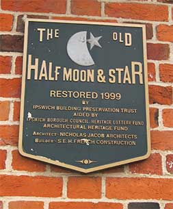
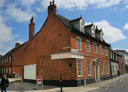
Above: The Half Moon & Star former public house on Barrack
Corner. The building is said in the Listing text to date from the 18th
century, with 19th century alterations. It may however be older, or
have replaced an older building; 'The Half Moon & Stars' was listed
in a church rate-book early in the 17th century and it is reported that
brewing took place here 'up to the reign of James I' (1603-1625).
It closed in 1985 and eventually, in 1999, became one of the
largest projects of refurbishment for accomodation by the Ipswich
Building Preservation Trust (see Links).
For more IBPT projects see the links on our Blue plaques below the 'Beecholme' entry.
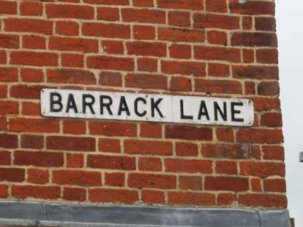
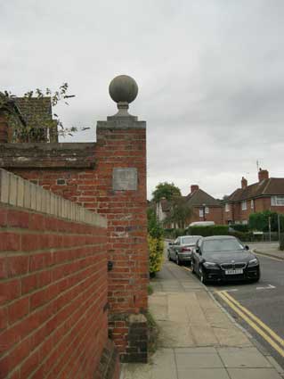
Barrack Lane
The street nameplate to the left in the above photograph is significant:
 2014 image
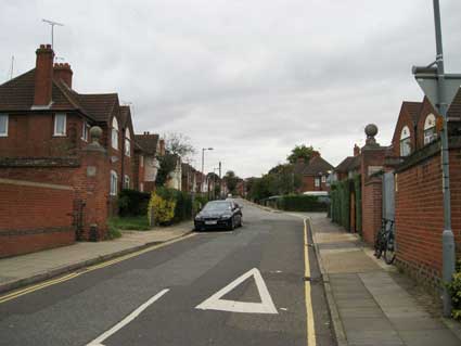
Walking north from Barrack Corner (the junction where St
Matthews
Street and Norwich Road meet), one can still see the brick gateposts
topped with ball finials of the Ipswich
Barracks. In modern times
Barrack Lane continues on to become Geneva Road with Cecil Road off to
the
right.
 2013 images
For over 150 years when the town had a barracks Ipswich was full
of soldiery, just as in medieval times when there were five Catholic establishments, it would have
seen many monks and pilgrims. It is hard to imagine the effects of
large numbers of such inhabitants on all aspects the town's life at
various times.
 Slightly enhanced image
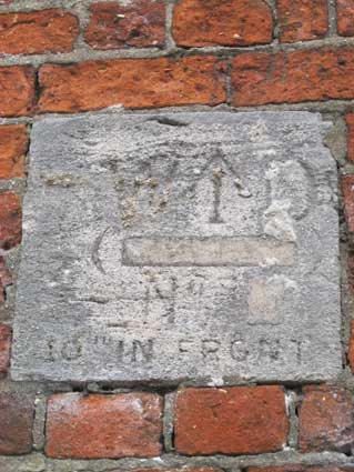
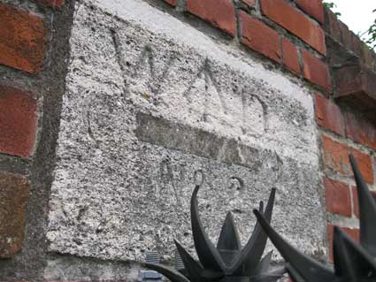
Looking the the tablet on the left Barrack Lane post (above) and
comparing it
with that on the right post (two views below, partially obscured by the
modern anti-climb spikes), we think that the inscription is:
'W·D
(---------)
No 2
10" IN FRONT'
Clearly a word has been deliberately cut out of the tablet
between the two curved brackets. Could it be 'IPSWICH'? 'W...D'
stands for 'War Department' with its customary arrow
between the letters. '10 inches in
front' presumably indicates the precise line of the boundary from the
face of the tablet. The left tablet appears to have
been plastered with mortar in the past to infill or cover the
lettering. Several other
inscribed stones showing broad arrow government marks indicating the
barracks boundary survive. See our Boundary markers gallery for more
information.
During the late eighteenth century, fears of an invasion of
Britain by the French, coupled with the convenient situation of the
town’s port for embarkation to the continent, resulted in large numbers
of troops being billeted in Ipswich.
The Ipswich Cavalry Barracks where built in 1796 and housed 1,500 men.
Located on 9¼ acres of land in St Matthews Parish, they were bordered
by St Matthew’s Street to the south, Anglesea Road to the north and
Berners Street to the east and Orford Street to the west (one assumes
that the nearby Gymnasium Street,
behind Coe's store, is named after the
troops' gym). The brick buildings of the barracks stood on three sides
of the parade ground. An officers mess stood along one side flanked
either end by barracks for the troops. Ipswich was well used to having
soldiers stationed within its limits but this was the first time that
permanent accomodations had been constructed for them. The first
regiment to move in were the Queen’s Regiment of Dragoon Guards. Later
the cavalry made way for artillery with units of both the Royal Field
Artillery and the Royal Horse Artillery stationed here well into the
20th century. St Matthew’s Church became the garrison place of
worship, with troops parading through the streets to the church each
Sunday morning.
The site was sold to Ipswich Corporation in 1929 which demolished the
barracks a year later to make way for council homes on what are now
Cecil and Geneva Roads. All that remains of the site today are the
entrance gate posts shown above, while a few sections of its boundary
walls can be found in surrounding gardens, some apparently with
tethering rings for horses set into them.
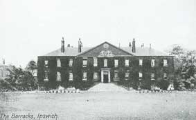 Old postcard
of the view from the parade ground
Old postcard
of the view from the parade ground
Fear of invasion during the second half of the eighteenth
century, saw the establishment of temporary barracks for up to eight
thousand men near to Round Wood on either side of Rushmere Lane with
maneouvres on Rushmere Heath. Two thousand men were employed to build
the wooded huts. This must have had a huge effect on the town’s
population of around eleven thousand. The public houses would have done
a roaring trade to the off duty men who would have had little chance to
leave town. The camp was used as a military hospital for men returning
from the Napoleonic Wars. A report from 1809 had 600 reaching the
hospital where “every patient had a separate bed with comfortable bed
clothing, and the attendance was entirely adequate”.
Bettley/Pevsner (see Reading List) points out
that: "Berners Street ... is comparable to High Street, but grander:
Berners Street was for the officers of the nearby barracks, High Street
for the non-commissioned officers."
Other barracks
Around the time of the Napoleonic Wars (1803–1815), there were two
other less permanent barracks in the town. One was Stoke Bridge
Maltings, situated by the
river, which were converted for the purpose. The buildings later
reverted to maltings. There is no visible evidence today of the second
site: a wooden hutted camp known as St
Helen’s Barracks that was
situated at the top of Albion Hill, just north of Woodbridge Road
in the vicinity of Brunswick Road (which still has a kink in the
carriageway to indicate the extension of the road after the demise of
the barracks), Belvedere Road (formerly
Parade Terrace) & Parade Road, which still exists. This too
closed about 1815. Nearby Hutland and Khartoum Road
reflect the former military nature of the area. See
Street name derivations.
See also our page on the East
Suffolk Militia Depot not far from here in Ivry Street. Also
Rushmere Baptist Chapel for a
historical footnote about troops on Rushmere Common.
Click for more about Boundary
markers, including those of the Artillery Barracks.
Home
Please email any comments and contributions by clicking here.
Search Ipswich
Historic Lettering
©2004 Copyright
throughout the Ipswich
Historic Lettering site: Borin Van Loon
No reproduction of text or images without express written permission