Stoke Street
Alright,
let's come clean. Apart from the street signs,
there is little lettering here, not that we know of. However, this was
too
intriguing a story to let it get away. 2012
image
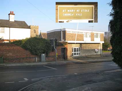
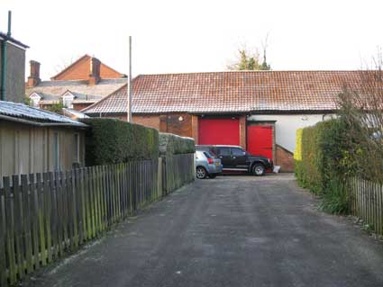
The above
photograph was taken from the jaws of Rectory
Road at the junction where Stoke Street to the right becomes Belstead
Road. Just in
passing, it is worth noting the sixties-style italic sans-serif caps
(justified to the left) of the
modernist building opposite:
'ST. MARY AT STOKE
CHURCH HALL'
Incidentally, it is just round the corner on the right
of the above photograph that one can find some houses provided by the
William Paul Tenement Trust (see More
almshouses).
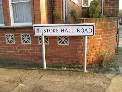
Stoke Hall Road
The tower
of St Mary-At-Stoke Church can be
seen behind
it and this is an historic Ipswich (or rather Over Stoke) church which
now has its own page on this website. The site of the church hall and
the car park were once occupied by buildingw hich were originally
cottages, then St Mary Stoke School and, further
down and for a time, Stoke Parish Poor House. Once the Ipswich Union
Workhouse
with its large garden and vegetable plots was built in Great Whip
Street, this workhouse building became part of the school. The
buildings were
later used by scouts and guides. Both buildings were demolished in
1966 to open up the view of the church from the road.
Rather wonderfully, the person in the white motorcycle helmet wheeling
a moped out
of the gate in the wall in the pre-1964 image (below) is using the same
gateway shown above beside the traffic light. It is this wall which is
of
interest. pre-1964 image
[UPDATE
2.9.2019: John
Barbrook writes '...having lived in the road for my first 30 years (and
been a
member of St Mary at Stoke Church for the last 74 years – and the
People’s Hall for the first 10), I can enthuse about a lot of the past
(and mostly unremembered) history of the area which you describe (as
can my wife, who was born in Rectory Road – of a lifetime railwayman).
For example, the old school once had four ‘floors’. A cellar,
first floor, second floor and an ‘attic’. In the picture which you
include, the scar of the dormer window still shows with its
different-coloured roof tiles. I well remember working up on the roof
(off scaffolding) helping Nelson Beales, a local jobbing builder, to
take out the dormer – in the 1950s, I think – which, due to rotten roof
timbers, was in danger of falling in.
But it was another Stoke “jobber” – Albert Kingham (our local ‘Mr
Fixit’) who did a great deal for the church there, who offered to
demolish all the old school buildings for nothing (simply for what
materials he could recover). This was to both open up the church to the
road and give us a long needed car park. Dear Albert – he did work
hard.']
The high, decorative brick wall, seen at the left in the photographs
above, continues up Belstead Road as far as Kirby
Cottage;
on the corner with Stoke
Hall Road there is a brick pillar topped with a white ball finial
(shown in the centre of the photograph below). It
all
suggests that the wall seems a bit tall and substantial for modest
terraced houses. It seems clear that parts of this wall are a
reconstruction made during the building of the houses in the early 20th
century. Kirby Cottage, a listed building, stands at right-angles to
Belstead Road and above the Stoke Hall site; it could well be that it
provided quarters for servants of Stoke Hall.
Stoke Hall
Road was the site of, guess what?: Stoke
Hall. Not to be confused with the so-called "Stoke
Hall"
('The People's Hall') near The Old Bell
pub. Between 1898, when The People's Hall was built, and
1915, until the Stoke Hall behind St Mary-at-Stoke church was
demolished, there were two 'Stoke Halls' within a few hundred yards of
one another. The only thing left
of the old hall is the stable block, but it
contains a secret...
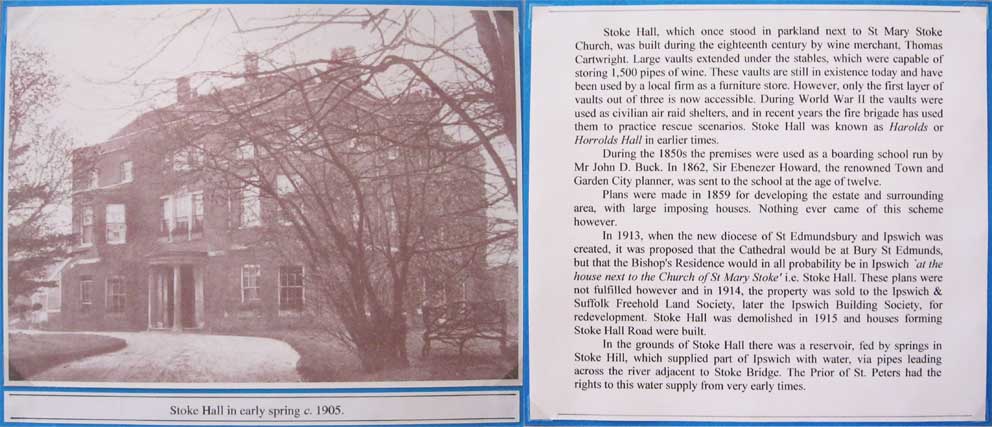
Stoke Hall was a large mansion house built by the wine merchant Thomas
Cartwright in 1744/45 (see the illustrations towards the bottom of this
web page). Cartwright also
excavated beneath Stoke hill a large series of wine cellars, 18 in all,
and a total of 180 feet in
length.
The Stoke Hall tunnels
The
official listing describes the tunnels: "Vaulted
wine cellars. Later C18, with some C19 and C20 modifications. red
brick, with some flared headers, in English, Flemish mixed bonds. On 3
levels all underground, the upper level projecting further south
towards the garden boundary of Landsdale Cottage and Belstead Road, the
lower level extending further north towards Burrell Road, and formerly
the river. Circa 180 feet in length. The lowest level comprises a
single range of vaults, the middle level of both parallel and single
ranges, the upper level a shorter parallel range. Part partitions
between bays, those to lowest level with semicircular headed brick
archways. Shallow brick vaulted roofs. Later brick side shelving at
intervals. The second level was rendered during World War II for use as
an
air raid shelter. Brick floors, except to lowest level which descends
to natural rock and sand. Brick spiral stair unites middle and lower
levels. Blocked lower level circular hole in floor. Access to vaults
now through superstructure. Evidence of further openings obscured by
render. Said to have a capacity of 157, 500 gallons of wine. It is
possible that these vaults were those built for Thomas Cartwright,
winemerchant builder of Stoke Hall, now demolished, in 1747. The above
ground warehouses, formerly stables etc to Stoke Hall, are not of
special architectural or historic interest."
The access to the tunnels is via an external staircase to the left of
the large red door. To the right, you can
see the sloping housing over a conveyor used to transport cases of
wine; this was removed during wartime and a staircase installed for use
as an air raid shelter. A conveyor is in
situ today. One source states that up to 200 people
could use the shelter during bombing raids, however, David Jones
mentions 'more than 500 people' (see below). All this poses the
question: what did the 18th century excavators find
amongst the (presumably) fossil-rich soils of Stoke hill? We know that
in
1846 when
the Eastern Union Railway company's Peter Bruff
engineered
the tunnel through the hill (later called 'Stoke Bone Bed'),
archaeologists, notably Nina Frances Layard
(1853-1935),
found fossilised evidence of
exotic prehistoric animals, some of which can be seen today in Ipswich Museum. It is possible that the railway
tunnel was cut through at a considerably lower level, which would be
much earlier in geological time. In 2013 the main part of the old
stables is occupied by Suffolk Marquees (see Links)
with a motorcycle mechanic business next door. We are grateful to Ian
of
Suffolk Marquees for showing us round and sharing information about
this intriguing site.
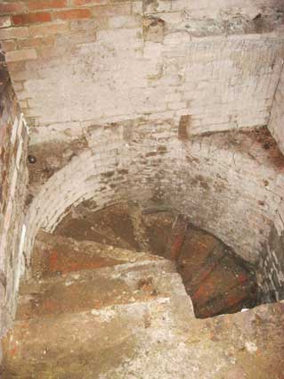
Tunnel exploration 2013 As one descends to the
tunnels via the narrow external staircase, it becomes obvious how
difficult it is to determine the age of any particular feature. The
tunnels were used as air-raid shelters during World War II, when
Ipswich docks and engineering works in particular were targets for the
Luftwaffe. It seems clear that many of the features were probably built
during the war. Small doorways and separation walls would be a nuisance
when the tunnels were being used to store wine, but they would have
been useful to protect those sheltering from bomb blasts. The rendering
of the brickwork and girder lintels probably date from this time.
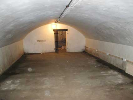
Wine cellars 2013 images
A chamber cement-rendered during World War II and now painted white,
opens onto a furhter room. Who knows about this wrought iron cell door
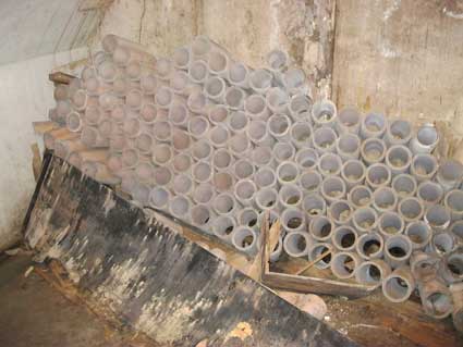
at the end? Was it original? It covers the
entrance to what has been called 'The Champagne Store', which contains
connected ceramic pipes which would have made a rather effective method
of
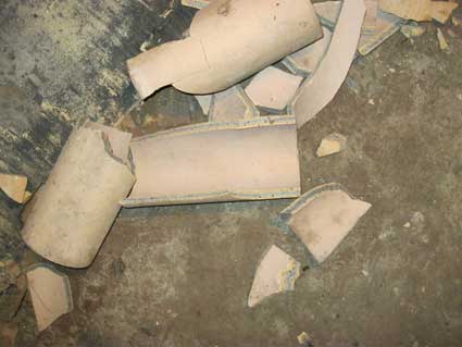
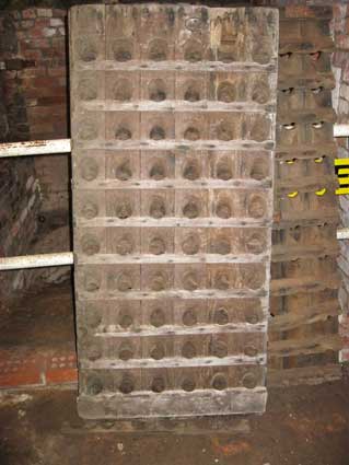
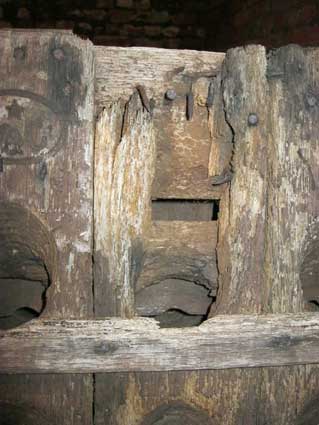
storing the bottles on their sides. They are in a sorry state.
Standing in front of a spiral staircase leading
to a
lower level are a couple of shaped timber frames which would have
supported the wine bottles.
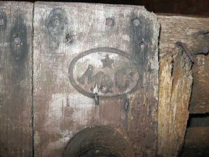
The close-ups below indicate age in the
timber, the impressed lettering:
'M&C'
standing presumably for 'Moet & Chandon', one of
the world's largest champagne producers. Moët et Chandon was
establishedin France in 1743. Thomas Cartwright, who had Stoke Hall and
its tunnels built in the 1740s would, if we make the obvious
assumption, have imported the wine in bottles by ship, landing at a
nearby wharf, probably Stoke Bridge Wharf (see our Wet Dock map) and being brought up to the
Hall by cart. Storing in the cool, dark conditions would be followed by
distribution via a local company such as Barwell & Jones, who ran
off licences in the area – in the 1980s we used to visit one on the
corner of Rushmere Road and Schreiber Road. Incidentally, in 2013
Barwell & Jones is the independent wine agency business of the Coe
Group. Ironically, Hayman, Barwell & Jones were rumoured to have a
tunnel beneath their premises in Fore Street (The Wheatsheaf, shown on
our Ancient House page) which linked
to the Stoke
Hall tunnels (see our paragraph on tunnel
myths below).
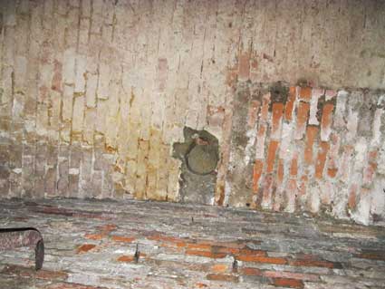
The tunnels as World War II air-raid shelter
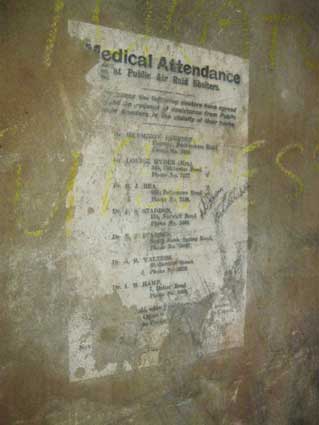
Looking at the tunnel photograph (below left), to the right of
the doorway can be seen a notice dating back to the wartime (a
remarkable survival) , or perhaps more correctly, the impression of a
notice left on the damp rendered wall:
The text reads:-
Medical
Attendance
at Public Air Raid Shelters.
[In an] emergency the following doctors have agreed
[to respond] to requests for assistance from Public
[Air] Raid Shelters in the vicinity of their house.
Dr. HERMIONE BOURTON[?],
Fairway, Bucklesham, Road.
Phone No. 7295.
Dr. LOUISE HYDER (Mrs.),
343, Colchester Road.
Phone No. 7177.
Dr. R.J. REA,
236A Felixstowe Road.
Phone No. 2469.
Dr. C.S. STADDON,
174, Norwich Road.
Phone No. 78807.
Dr. E. [W?] STADDON,
South Bank, Spring Road.
Phone No. 78807.
Dr. A.R. WALTERS,
40 Berners Street.
Phone No. 3259.
Dr. L.M. HAMP,
7 Dalton Road.
Phone No. 2469.
[Final passage unreadable.]
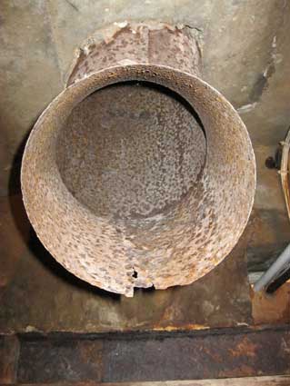
A metal flue would have provided ventilation and the
patina of rust demonstrates the
effects of the extreme dampness of the atmosphere in the tunnels.
The introduction of hundreds of individuals during Air-Raid alerts
would have greatly increased the humidity in the tunnels.
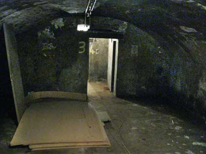
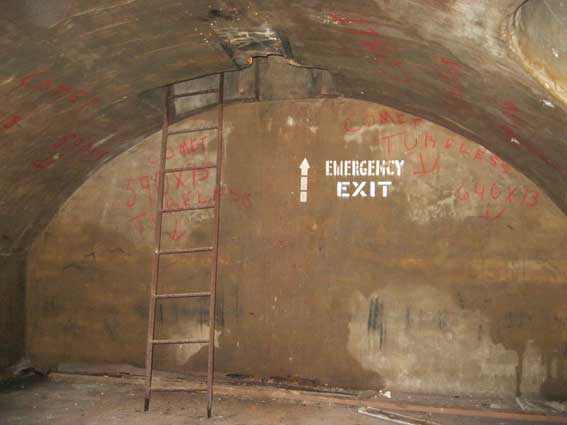
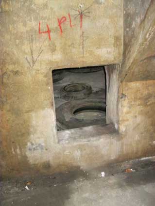
The photograph below is a peach. The arrow and lettering:
'EMERGENCY
EXIT'
must surely date back to the air
raids, but look undegraded by time and dampness. No doubt the rickety,
rusty ladder is a later addition, but climbing up it gives a view of
the original brickwork vaulting (shown below).
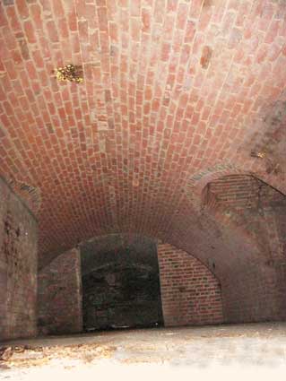
Tunneled into the stony, sandy Stoke Hill, then lined out as a
weight-bearing barrel-vault in Suffolk red brick: quite a feat in the
difficult conditions and lack of access. The image to the right is
looking vertically at the apex of a barrel-vault with a ventilation
flue in the centre.
Former Ipswich Museum curator, David Jones’ fine book Ipswich in the Second World War
(see Reading List) tells us more:-
“The largest public shelters were the pre-existing cellars in Stoke
Hall Road, the only shelter [in Ipswich] to hold more than 500 people.
The records suggest a shelter de luxe. Like other public shelters, it
had illuminated signs which were switched on in line with the blackout
and off at 10.30 or during an alert. It was heated by a Cara stove. It
had its own stirrup-pump, two buckets and fire extinguishers. In
addition to a first aid box, [part] was set aside for a casualty
holding section provided with extra lights. The emergency exit was
purposely widened to take stretchers. A small canteen was set up at
which tea and biscuits could be bought. (There were others at Smiths
Suitall, Smyth Brothers, Central Cinema, Smiths Albion House, Co-op
Furnishing Department and the Lads Club cellars.) As the intensity of
raids diminished so, too, did the numbers using the shelters regularly.
The Emergency Committee found, on 3 April 1944, '21 familes, 46 persons
use the shelter habitually. Nine had no domestic shelters, two
Andersons with bunks, six Andersons no bunks and four Morrisons. The
shelter families allowed to continue to use Stoke Hall but felt that
the Morrisons would be reallocated if needed.'
By 1 March 1945 only 14 people were still using the shelter so part of
it could be closed."
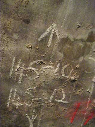
Rubber tyre storage
Not too long ago, the tunnels were used by a
tyre
company to store their wares. There are a great deal of chalked (and
sometimes painted) stock numbers and descriptions on the wall. The
chalk seems to blossom out from the damp cement surface. As you can see
by the right-hand images below, some tyres still lie around in one part
of the catacombs.
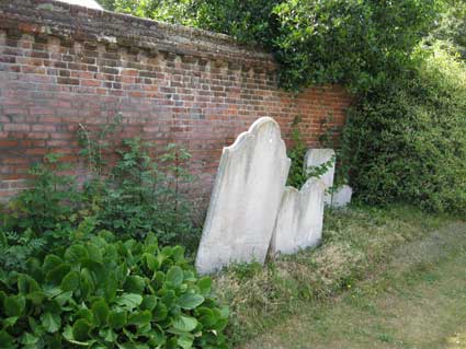
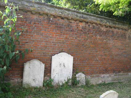
St Mary-at-Stoke Church
The relationship between the 1744/5 Hall and the
nearby
St Mary-at-Stoke Church is illustrated by the photographs below. This
substantial wall, about 7 feet high, divides the churchyard from the
present gardens of the houses on the east side of Stoke Hall Road. The
Hall had its own entrance to the churchyard,
although we hadn't been able to locate it until Heritage Open Days in
2019 – see our St
Mary-at-Stoke Church page for photographs.
The fascade of the Hall
would have stood about a third of the way into the present Stoke Hall
Road, with fairly narrow gardens leading up to the drive just the other
side of this wall Apparently, long before Stoke Street and Burrell
Road (see Street name derivations)
existed, a sloping drive was cut into the rather precipitous hill on
which the church stands, but outside the wall line which still exists.
It followed the curve of the churchyard wall and eventually led to the
circular drive by the front door. A staircase apparently
still exists at the Burrell Road end of
the Stoke Hall stables site and runs down what we can only describes as
'the cliff' which overlooks the small gardens at the back of the
Burrell Road houses. The stairs lead to yet another entrance to the
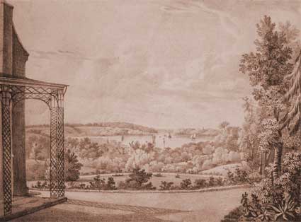
tunnels. There was a summer house/gazebo in the gardens at the top
which would
have overlooked the upper part of the River Orwell in the much wider,
pre-canalised river at or near the foot of the cliff (see the
illustrations below).
Stoke Hall suffered perhaps from the location
which made it desirable in the first place. It was probably one of
several residences built up Belstead Road in what would have been quite
remote, private spots. As time moved on and road, then rail, and
housing development in Over Stoke grew, the sizeable house would be
seen to be on a restricted piece of land, less desirable for wealthy
owners perhaps because of the proximity of heavy industry, smoke, noise
and so on, not to mention the working classes. Perhaps the number of
owners and the decay and eventual demolition in 1915 is not such a
surprise, when The Ipswich & Suffolk Freehold
Land Society, who
bought the site, had been
at the forefront of building affordable housing (notably in
'California'
– discussed in our Rosehill case study
page) for large numbers of inhabitants of the Victorian town.
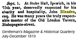
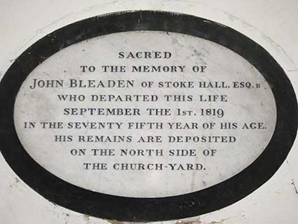
John Bleadon From
Colleen McDonald 13.7.2015
John Bleaden of Stoke
Hello, I'm on the ancestor hunt and came across your website. I'm
hoping you can fill in some gaps for me. I am wondering what the
connection the Bleaden family is to Stoke Hall and to Ipswich. Do you
have any idea what Stoke Hall was in 1819?
My 4th Great Grandfather, John Bleaden's obit: Memorial in St Mary Stoke Church
Marriage
details of Mary Bleadon, 1803 Images courtesy Colleen McDonald
Tunnel
myths
Having no idea as to their origin, people began making up tales about
these underground workings, that were used as air raid shelters in
World War Two. A tunnel was said to lead from there to the 'folly'
called Freston Tower, on the banks of the
Orwell. Probably built between 1550-1560 by Edmund Latymer, this red
bricked six-storey building was perhaps a 'standing' or look-out tower
of some kind. A second passage from Stoke Hall ran to Greyfriars
Priory, near where the ring road (here Franciscan Way) crosses Princes
Street. The priory was founded sometime before 1236, and only a segment
of flint walling now remains, incorporated into the Greyfriars
Concourse. On the north side of the river, the Woolpack pub in
Tuddenham Road is said to have had smuggler's tunnels running south to
the dock area. There are allegedly deep (and supposedly haunted)
cellars beneath the Fore Street site of the wine merchant Hayman,
Barwell & Jones, which are said to form part of a system of
tunnels. They
are rumoured to link up with the Ancient
House in Buttermarket, the 19th century Custom
House in Key Street, Christchurch
Mansion to the north, and the site of Holywells manor to the
south-east. The Coach and Horses Inn used
to stand in Lower Brook Street. On the opposite side of the road were
the premises of Messrs. E. L. Hunt, that were on the site of a mansion
house owned by Charles Brandon, Duke of Suffolk and husband of Mary
Tudor. A tunnel was said to connect the two.
The Ancient House (or Sparrowe's House) stands in the Buttermarket, at
the corner of St. Stephen's Lane. In 1801 a workman falling thru
the roof came upon a hidden room, supposedly part of a pre-Reformation
chapel. It has long been believed that Charles II was secreted in that
room after the battle of Worcester in 1651, and thus has arisen the
tale of his escape by secret tunnel from the Ancient House to
Alnesbourne Priory in Nacton parish, about 3 miles away. Now Priory
Farm, the only part remaining of this Augustinian house, founded around
1200, is a part of the wall of a barn. Not too far away from the
Buttermarket is The Halberd (later Paddy
McGinty's) pub in Northgate Street, where a bricked-up entrance into
Ipswich's vast tunnel system is to be found in the cellar. The ghostly
monk that haunts the pub is said to have helped someone come from 'the
monastery' through the tunnels, and for his pains was murdered by being
drowned in the old well that can be seen in the lower bar.
Urban myth heaven: if we desire hard enoughsomething to be true, it may
just become true. Many such myths can be found on The Lost Expedition: in search of legends,
stories and tales from around Suffolk website (see Links).
The Hall Sale of Stoke
Hall
As mentioned, Stoke Hall was a large mansion
house built by the wine merchant Thomas
Cartwright in 1744/45. Cartwright also
excavated beneath Stoke hill a
vast series of wine cellars (detailed above).
In 1819 the Hall was described
in a sale notice in The Bury and Norwich Post [click title for a PDF of the article] for Suffolk, Essex,
Cambridge, Ely, and Norfolk Telegraph (Wednesday November 1819
(no. 1951), page 1. The sale followed the death of the owner John
Bleadon. The gardens are described as some sort
of Elysium:
‘TWELVE ACRES
It might be invidious to select any particular spot to panegyrise the
views with which this enviable property abounds; but it may be
permitted to state that from one extremity of the Plantation to the
North, which is protected from the wintry wind by the wide spreading
oaks, the view of the Church, hanging in majestic grandeur over the
thriving shrubbery, forms an object that cannot well be seen without
being properly appreciated. In one of the Meadows is the Water Course
(or House); from this source a considerable part of the town of Ipswich
is supplied with water, which at present gives an income of near 100
pounds a year, and from which a large one may safely be contemplated.’
See also our page on Water in Ipswich.
In 1892 the Hall
was up for sale following
the death of the owner Robert James Ransome (1830-1891) of Ransomes and
Rapier, railway engineers, whose factory was quite close by at the
Waterside Works on Griffin Wharf (see our Wet
Dock map). See our précis of the company at the bottom of this
page. The auctioneers
described it
as a
“Fine Old
Mansion” boasting three reception rooms, billiard room, six
principal
bedrooms on the first floor, seven more bedrooms on the second floor,
with kitchens, offices, greenhouse, stabling, pleasure and kitchen gardens, all standing in 1 acre
three roods of land
and adjacent to the church of St Mary-at-Stoke. Written in the margin
of the auctioneer’s notices of 1892 are details of (what
appear to be)
subsequent owners including Dr Elliston, Miss Battersly of Cauldwell
Hall, and the Ecclesiastical Commissioners who sold it to the Ipswich
Freehold Land Society in July 1914. During its
time in the ownership of the
Ecclesiastical Commissioners it was under consideration for use as the
residence of the Bishop of St Edmundsbury and Ipswich, being next to
the church and with the Hall having its own entrance to the churchyard.
The house in its decayed state was pulled down
in 1915 at a cost of £50, but the
cellars remained. Stoke Hall Road was created
with a row of F.L.S. houses which we see today.
The stables of the
Hall were not demolished and continued to be used – latterly
by a local
removals company then a motor repair shop. We must be careful to
distinguish between Stoke Hall and the mansion and grounds of Lord
Gwydyr's Stoke
Park, which was not far away (see our Bourne
Park page for an image and description), near today's Fountains
Road on the Stoke Park housing estate.
These illustrations of Stoke Hall show a
substantial Georgian residence
overlooking the Gipping valley below.
Below: a photograph of Stoke Hall from c. 1905 plus description by the
Over Stoke Local History Group which gives further morsels of
information about the house and grounds.
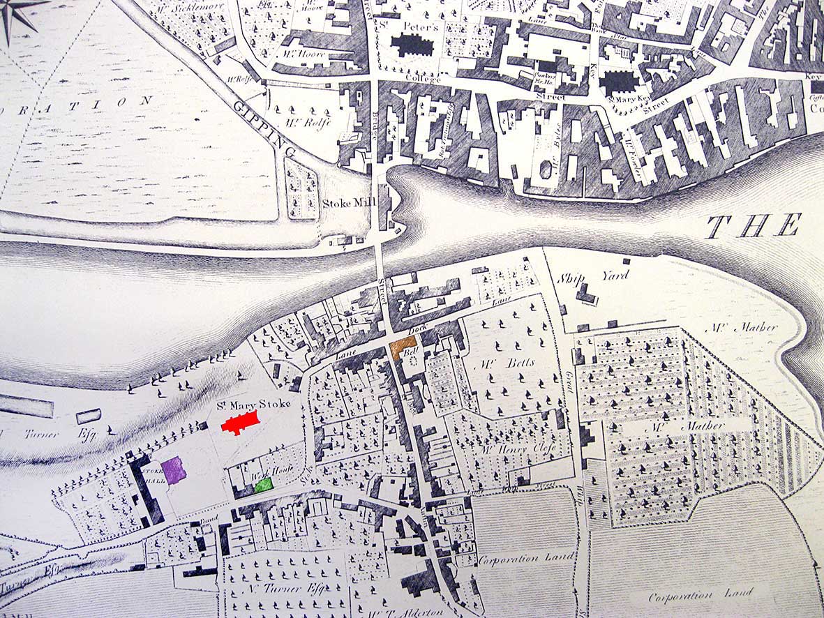
On Pennington's map of 1778 (detail
below) we can see
St Mary Stoke Church at the
lower left corner of this map detail, with Stoke Hall, then the stable block to the south-west
of
it. The line of 'Stoke Lane' (now Stoke Street) comes up from The Old Bell (shown in brown) corner curving
steeply left, then
right as it does today, past the 'Work House' (shown in green) south of
the church (shown in red) and into
Belstead Road. Stoke Hall is shown in purple. Note also the tide mill
to the north of the bridge with
its mill pond to the west of it. Also the inlet on St Peter's Quay on
the dock, north of – and on a line with – Great Whip Street in Over
Stoke: this is the line of the original Anglo-Saxon ford across the
river, i.e. the nucleus of the first Anglo-Saxon town, Gypeswic. 1778 map
1780 map Hodkinson & Jefferys (Faden)
map of 1780
– detail above – shows the layout of river, lanes and structures on the
Stoke side of the bridge. Bridge Street
runs from the town centre southwards past the Stoke tide mill, over the
river and across the Stoke Street/Dock Lane junction into the narrower
Bell Lane beside The Old Bell public house.
It meets Little Whip Street which runs eastwards to meet Great Whip Street (the north end of which
is the site of the original ford over the Orwell to reach the town
before a bridge was built. Stoke Hall, with the oval carriage drive in
front is shown with its long stable block and outbuildings (most still
standing today). The 'Work House' fronting Belstead Road is labelled;
this was later a school (see the monochrome image of the building at
the top of this web page).
1867 map Above: in the mid-19th Century, a
carriage drive leading to Stoke Hall was
built around the curving northern
boundary of the churchyard as can clearly be seen on E. E. White's Map of c.1867 (below). Although partially covered by the legend 'St Mary at
Stoke', the drive to Stoke Hall can be seen immediately above the
church (to the left of '31').The
start of
this driveway can still be made out today as it rises among the trees
between the churchyard wall and the existing brick retaining wall to
the west of the junction of
Stoke Street/'Burrell Street' – as it is labelled here. If you delve
around among the grass and ivy on the corner, you can find the top of
one of the original gate posts at the entrance to this carriage drive.
On the map
Vernon Street has been cut through, causing demolition of part of The Old Bell public house near to Stoke
Bridge.
1792 map
Above: Isaac Johnson's sketch map and illustrations of
Stoke Hall – taken from Blatchly: Isaac
Johnson, see Reading list. The
cartouche contains the text:
‘STOKE HALL
in IPSWICH Suffolk
with the Buildings, Gardens, Yards
PLANTATIONS & MEADOWS
The Property of
WM. TURNER, ESQR.
Aug. 1792.’
The detail below shows the hall
and church as pictograms, rather than accurate aerial views with stable
block and gardens. The sharp gradient down to the river is indicated by
hatching and beyond a slightly puzzling, short 'Canal', which must
surely be a rectangular man-made lake in 'Canal Meadow'. the land to
the left of this is Waterhouse Meadow: see our Water
in Ipswich page for another Johnson sketch map of this area showing
how a water pipe from the Stoke Hall estate provided a supply over the
river to the Priory of St Peter & St Paul and the northern quays.
The small hamlet of Stoke
developed from the medieval period. The name
is a contraction of 'stockade', as it was an easily defendable spot
above the river and marshes. The site of the present day river bridge
was
the most accessible crossing point from high ground to the south of the
River Gipping over the largely impassable Corporation Marshes to the
north, into the town centre of Ipswich. St Mary Stoke Church
(Listed Grade I) was built on the most favorable local site, a
promontory which rose steeply up from the river and which enabled the
church to be seen over a wide area. St Mary's dates from the 15th
Century (the date of its hammer beam roof) or earlier, but was
extensively enlarged and restored by London architect William
Butterfield in 1870- 71. Clearly this site would have been a favourable
place for Thomas Cartwright's 1744 mansion on the area behind the church.
Disambiguation
(in the terminology of Wikipedia)
1. 'Stoke Park', while being the name of the parkland, is also the name
of the Burrell mansion – here we call it
'Stoke Park Mansion' to make it clear. It has been demolished.
2. 'Stoke Hall', built on the rise of Stoke Hill and next to St Mary-At-Stoke Church, was built by
Thomas Cartwright in 1744/45 ans was once the home of Robert
James Ransome (1830-1891). It
has been demolished.
3. 'The People's Hall' in Stoke Street,
close to The Old Bell Inn, has confusingly
had the name 'Stoke Hall' added to its fabric. It still stands.
[UPDATE 19.12.2013: "I have
just been reading your web site regarding Stoke Hall and would like to
add a few comments.
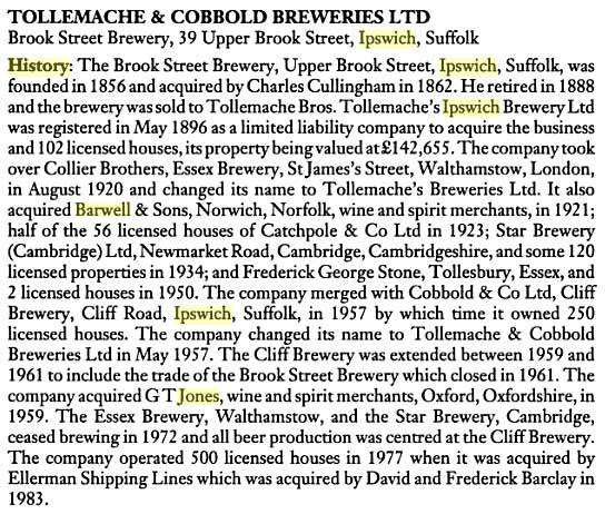
1. Barwells Wine Merchants were a subsidiary of Tollemaches
Breweries before the amalgamation with Cobbold & Co and there was a
further amalgamation with T. G. Jones of Oxford probably in the late
1950s, prior to this Cobbolds had their own wine division based in
Lower Brook St. which had outlets in Great Colman Street, Nacton Road
and Rushmere Road and probably others. Barwell and Jones was later
housed in the listed building [The Wheatsheaf], 24 Fore Street which
was originally the
residence of the Manager of the Bottling Dept of Tollemaches Breweries.
2. I was surprised that you were unable to establish the gateway
between the Hall and the churchyard as I can remember this old boarded
gate when a choirboy at St. Marys in the 1940s.
As a matter of interest my father, who was bought up at 26 Stoke
Street, used to play in the tunnels of the Hall as a boy.
I joined the choir at St. Mary (at) Stoke in Sept 1947 and am still
there.
I started work in 1951 at Tollemaches Breweries Ltd based in Upper
Brook Street (my office can still be seen from the street) and
continued working in the Surveyors Dept until the firm’s demise. Moving
to Pubmaster thereafter and still looking after the public houses in
the town and further afield. Hope this is of interest. Regards, Ken
Brock" Many thanks to
Ken for getting in touch and furnishing further details.]
Above – the Tollemache / Barwell & Jones chronology from The brewing industry: a guide to
historical records by Lesley Richmond and Alison Turton.
Manchester University Press, 1990.
Newcomers to Ipswich and, we suspect, many current residents don't know
the difference between Ransomes, Sims & Jefferies (manufacturers
of ploughs and tillage machinery, steam engines, grass-cutting
equipment, trolleybuses, threshers, tractors, combines, electric
trucks) and...
Ransomes & Rapier Engineers and makers of machinery for railways and all kinds
of public works.
Waterside Works, Griffin Wharf, Ipswich, and 32 Victoria St, London.
Griffin Wharf was an appropriate site for the railway-supplier works.
The opening of the Eastern Union Railway in
1846 from Colchester to the first terminus
station at nearby Croft Street later became engine sheds and sidings
once Stoke Tunnel was built by Peter Bruff (who
lived at Handford Lodge); eventually the present
Ipswich station
opened on Burrell Road in 1860.
1869 Formed as branch of Ransomes, Sims and Head to concentrate on the
railway side of the business and other heavy works. Four engineers, J.
A. Ransome, R. J. Ransome, R. C. Rapier and A. A. Bennett, left the
company by agreement to establish the new company on a site on the
River Orwell. The original partners were Allen Ransome, his son Robert
James Ransome [owner of Stoke Hall] and Richard Christopher Rapier. Chairs, points and rails
were made. They also built steam and breakdown cranes; portable and
stationary engines.
1875 James Allen Ransome died.
1876 Three small locomotives made and exported to China.
1890 All-Round Titan Railway Crane. Illustrations and article in The Engineer.
1896 Became a public limited company. The company was registered on 17
April, to acquire the business of engineers of the firm of the same
name.
1897 Two 30-ton travelling steam cranes for construction of Vera Cruz
Harbour.
1904 Installed 5 sets of the largest hydraulic buffer stops at Kings
Cross station, London, and another 5 sets at the Central Station,
Glasgow.
1914 Engineers and ironfounders. Manufacturers of hand, steam, petrol
and electric cranes, traversers and turntables, capstans, tanks, water
cranes and pumps, bridges, hydraulic buffer stops, castings,
contractors' and railway plant, "Stoney" sluices, ice and refrigerating
plants, concrete mixers etc.
1937 Engineers and ironfounders.
1939 Aircraft industry suppliers specialising in launching catapults
for aeroplanes. Rapier catapults have been supplied to the British
Admiralty and to certain foreign navies, but were also useful on shore.
Ransomes and Rapier were the originators of mobile cranes, which have
been used for many years on British and foreign airports and elsewhere.
Being fitted with pneumatic tyres they are essential wherever
aeroplanes are in use.
1958 Newton, Chambers and Co. acquired Ransomes and Rapier; purchased
by exchange of shares.
1960 Advert for Walking Draglines for mining.
1961 Engineers and ironfounders, specialising in contractors' plant,
mobile cranes, excavators, walking draglines, railway plant and
equipment, sluice gates and water control machinery. 2,000 employees.
1963 Newton, Chambers and Co. sold 40% of Ransomes and Rapier to
Koerhing of Milwaukee in a share deal.
1965 Ceased making walking drag lines because of the rise of oil and
reduction in use of coal.
1972 Newton, Chambers and Co. planned to close Ransome and Rapiers and
move the business to Thorncliffe but the group was taken over by
industrial holding company Central and Sheerwood who kept Ipswich open.
1976 Ransomes returned to making walking drag lines in view of the
increased use of coal.
1988 Bucyrus-Erie acquired the dragline assets of Ransomes and Rapier
Ltd.
[The above information comes from Grace's Guide, see Links]
Our Bourne Park has much more about
Ransomes & Rapier.
See our Ransomes page for a photograph of
a Ransomes & Rapier buffer housing from a railway in Kalka, India.
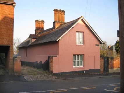
Kirby/Lonsdale Cottage, 2
Belstead Road (Nathaniel
Kirby)
A contributor to the Bourne Park page
had suggested a link between a name on the war memorial in the park and
the Stoke Hall site. However we received a further update (scroll down).
"As a matter
of interest one of those listed in the
first World War I [memorial] is Pte. Nathaniel Kirby, 4th Battalion
Suffolk
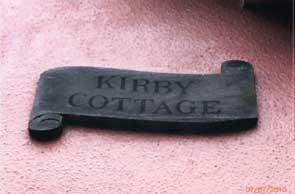
Regiment. The reason I mention that is because there is a building at
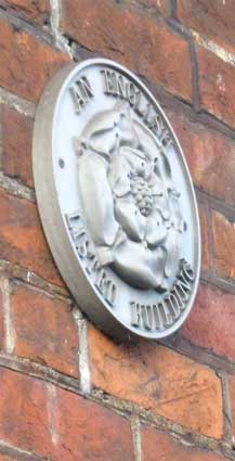
the bottom of Belstead Road with a wooden plaque and the words 'Kirby
Cottage' on it and around the corner it's got a listed house sign."
Toiling up Belstead Road hill away from Stoke Bridge, cast a glance at
Kirby Cottage and it's from a different generation from the surrounding
houses and sits differently in relation to the roadway; compare with
the house called 'Chimneys' on the same side near the top of the hill.
[UPDATE 14.12.2012: a long shot
of Kirby Cottage (which is Listed Grade II as 'Lonsdale Cottage'
with its Listed building crest.] 2012 images
The Listing text for 'Lonsdale Cottage' reads:
"A
red brick
building with late C18 or early C19 external features, possibly with an
earlier core. It stands at right angles to the road and is gabled and
plastered on the road frontage. The east front, to the garden, has
double-hung sash windows in flush cased frames with segmental heads.
The south end has 1 window range of C20 casements. Roof tiled, with 2
gabled half dormers and 2 chimney stacks, each with 3 diagonally set
shafts." Kirby Cottage runs at right angles away from Belstead Road and
is parallel and close to the stables building and Listed vaults
of the
long-demolished Stoke
Hall. It is most
likely that this cottage was part of the 18th century Stoke Hall and
was used as servants' quarters.
[UPDATE August 2018: The
following extensive response from Diana and John Stokoe to our original
piece suggesting a possible link between the Bourne Park war memorial
and this building gives further fascinating detail about this site:-
"My husband and I lived in this house from about 1984 until 1996. We
were members of The Ipswich Society & passionate about history. We
discovered the cellars underneath the front garden (there was no flying
freehold or other mention of them in the deeds to the house.)
When we bought the cottage there was absolutely no mention of any
cellars. We didn’t know that they were there. One day we decided to
plant a small Japanese acer in the middle of the front lawn. In doing
so, John uncovered the top of old arched brickwork. At that time,
extensive renovation work was being carried out on the Ancient House in
the Butter Market & John had seen, uncovered in the road in front
of the building, exactly the same sort of thing so he immediately
recognised what it meant. Naively, we approached the owner of the barn
in Stoke Hall Road & he invited us to have a look around when we
wanted. We talked to the experts at the Ipswich Society and we arranged
to go down with ropes, torches, etc. with three of the senior members.
That was when the idea of trying for Listing first arose so we put
together all of our research & it was presented to the English
Heritage brick expert who came from London to view the cellars. We had
been told that Listing is only for visual amenity & so we would
never achieve it for the cellars, most of which lie under the barn in
Stoke Hall Road. However, the evidence of our extensive research and
the quality of the brickwork achieved immediate listing. Kirby Cottage
already had Grade II Listing whilst the [Stoke Hall] barn was not
considered to be interesting enough.
The timber framed front part of the house can be dated back to at least
1747 whilst the back half is a later Victorian extension. At one time
it was three cottages. Behind it is an old stable building whilst the
Stoke Hall Road barn was carriage house, brew house, pig sties, etc.
The cellars are on 3 levels at the river end, culminating in a well
(& not a secret smugglers´passageway, as local legend claims!) and
are on 2 levels below Kirby Cottage's front garden. Everything that
we’ve seen or read convinces us that the hole at the river end of the
cellars was connected with the movement of water across the river. This
was a very valuable source of income for anyone who had control of it.
100 pounds per year was a great deal of money! The cellars could hold
147,500 gallons of wine for the wine merchant [Thomas Cartwright] who
had Stoke Hall built. The cellars have arched ceilings and the arched
barrel vaults are still in place along the side walls. There was
evidence of an arched entrance from our front garden & steps down,
too, excavated after their discovery on old maps. During the Second
World War the cellars were used as air raid shelters & there are
still painted signs on the walls relating to this function.
We moved from 43 Belstead Road into Lonsdale Cottage. The cottage was
renamed Lonsdale Cottage when the very beautiful Lonsdale House next
door, on the corner of Willoughby Road, was demolished and the Lonsdale
flats were built on its site, in the 1950s, I think. Our cottage had
never had a house number but was always known by its name. John
reminded me that until Lonsdale House was demolished, the cottage was
called Kirby Cottage. It was as if the owners of Lonsdale House wanted
the name to continue both in the flats & in the cottage. We simply
reverted to Kirby Cottage. The Post Office started to get difficult
when we complained that our post kept disappearing into Lonsdale Flats.
They insisted that we start to use the number 2 Belstead Road but since
there was also a number 2 Lonsdale Flats this didn’t help matters and
an interview with the Ipswich Postmaster made no difference. Our
research showed that way back in the 1700s the cottage had been called
Kirby Cottage so we changed the name back. We believe that the name
relates to Kirby the Ipswich cartographer: at least one of his maps is
produced from a very similar viewpoint to that of the cottage. We
carried out extensive studies of all of the local directories &
never found any reference to a Nathaniel Kirby though we have the names
of the residents throughout the 20th century.
So, we changed the cottage name back to a much earlier name. We had the
wooden name plate made by a craftswoman in Shotley. We put up the
Listed building plaque – probably an offence on a Listed building! We
resisted attempts to sell off the quarter of an acre, walled back
garden which still has very old steps going down onto the plot below
(Burrell Road). Again, these were uncovered after we found them on old
maps. We resisted attempts to develop the barn since its windowless
back wall gave total privacy to the lovely cottage garden. By the way,
we left, in the garden, the stone fragments of church window frames,
presumably remnants from the earlier redevelopment of Stoke Church.
We still have original deeds & old documents relating to the
cottage & surrounding land. We have copies of all of the old
relevant Ipswich maps, we have photos of the cellars and copies of the
Stoke Hall sales catalogue, as well as lists of previous residents with
dates. Incidentally, we tried [but were unable] to buy the cellars
under the cottage’s front garden, wanting to put in simple grilles to
partition them off from the rest of the cellars. We had no wish to do
anything but preserve them. At that time the cellars below our front
garden were just being used to store tea chests of ship’s documents.
It was clear from evidence of stairs up, arches & steps down, etc.
on the front garden walls that the whole of the front garden, except
for a narrow strip along the front of the cottage, had once been a
building. From old maps we were able to uncover steps down &
lifting a single stone slab at the bottom enabled us to peer down into
the cellars. Having cellars so close to our property but over which we
had no control clearly worried us. In such circumstances you should
have something called a "flying freehold" which means that you only own
the upper level of a property. (Our previous property, a lovely art
nouveau house at 43, Belstead Road was built over the Ipswich Station
railway tunnel & our deeds included a clause which stated that we
were not to drill for oil on the premises!)" Many thanks to Diana and John for telling
the story of their time at Lonsdale/Kirby Cottage.]
Much of the above, of course, takes place above or close to the railway
tunnel; see our E.U.R. page for more
information about Over Stoke and the railways.
 2012
image
2012
image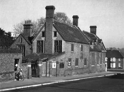 pre-1964 image
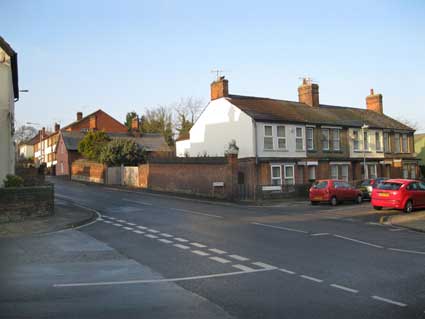
 2013 images
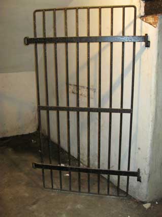
 Memorial in St Mary Stoke Church
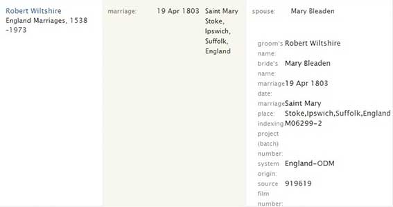 Marriage
details of Mary Bleadon, 1803
Marriage
details of Mary Bleadon, 1803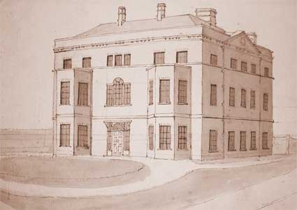
 1778 map
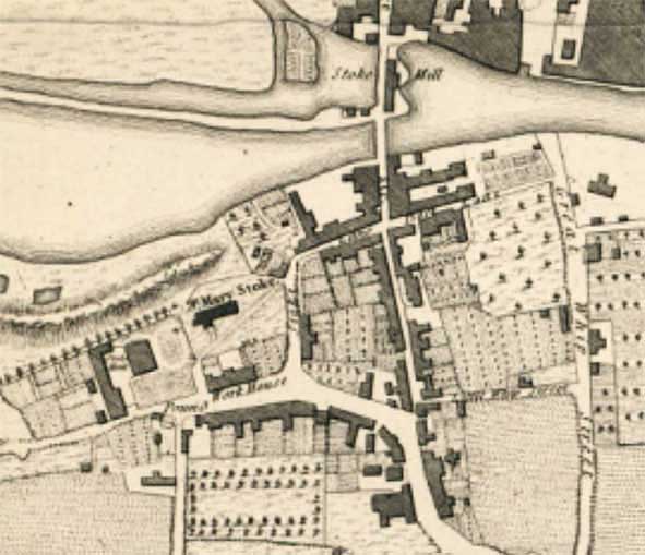 1780 map
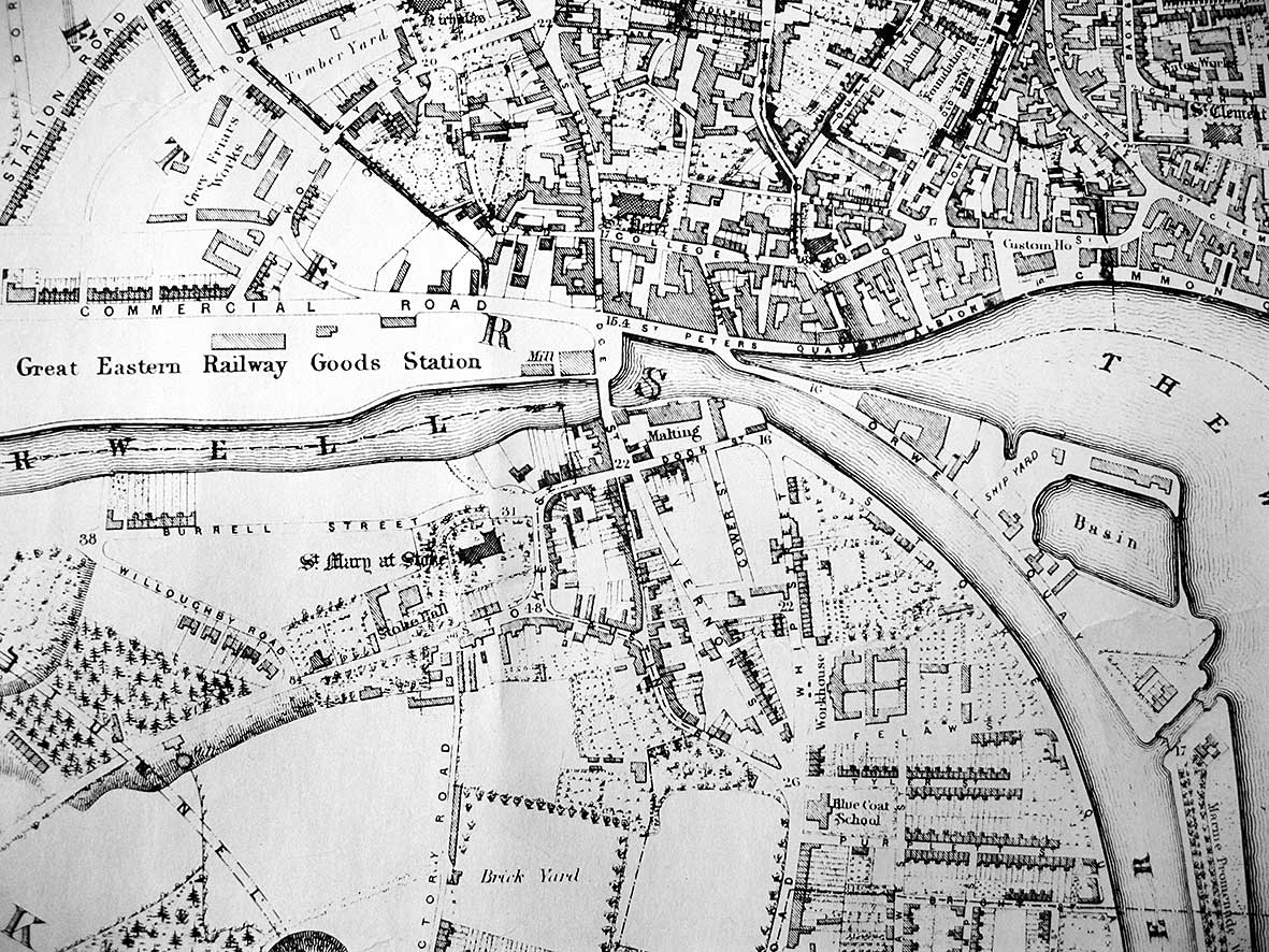 1867 map
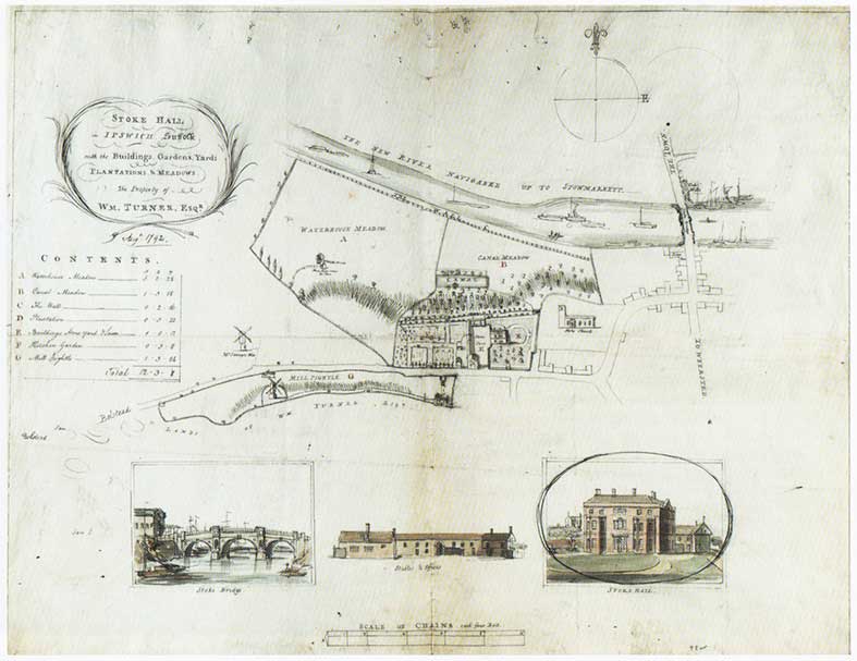 1792 map
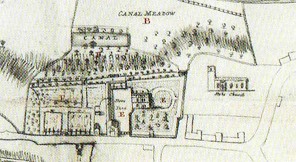
 2012 images