Wharf and quay names: the new blue nameplates, 2021
Early in 2021, blue street nameplates started to appear around the Wet
Dock. This was an initiative by the Ipswich Maritime Trust working
closely with Ipswich Borough Council to mark the correct names of quays
and streets around the Wet Dock. On a cold misty morning in February
2021, these photographs were taken. There are no blue nameplates on the
Stoke side of the Wet Dock.
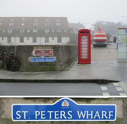
Working from Stoke Bridge down towards the lock, the first blue
nameplate changes not only the colour, but the name shown on the
earlier plate it replaces.
St. Peters Wharf
 2021
images
2021
images
See our Stoke Bridge page for
the earlier 'St. Peters Dock' nameplate. Continuation
of the controversial
use of the full stop after the contraction for 'Saint' [citation: The Oxford English Dictionary].
New Cut East
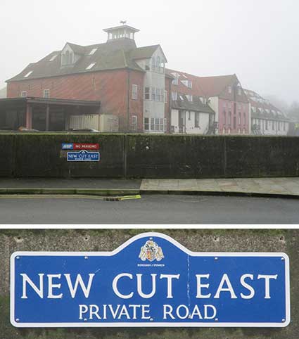
This is probably the first such nameplate since the one shown on
our New Cut East page.
Albion Wharf
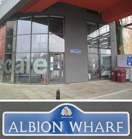
Just across from the New Cut East nameplate is the first for
Albion Wharf., attached to the Dance East/Jerwood Dancehouse building.
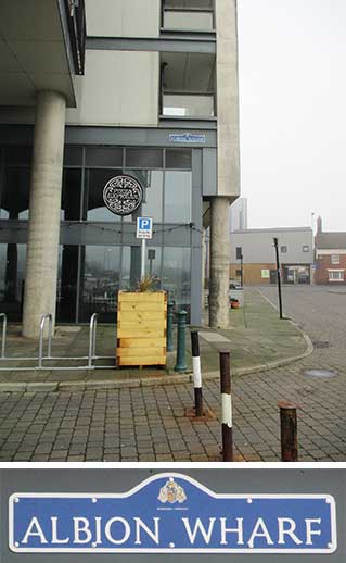
Albion Wharf reaches all the way from Foundry Road down to Pizza
Express. This nameplate is set quite high because of the glazed
frontage.
The main omission here is Common Quay (from the Custom House to
Wherry Lane), which has been known by this name for over a thousand
years. Older quays such as Common Quay cannot be formally recognised by
Ipswich Borough Council because this isn't a street in the Post Office
register of Ipswich streets, so it cannot have a street name or street
nameplates. Apparently any sign, even of a different colour, showing
the name 'Common Quay' must not resemble a street nameplate in any way.
Wherry Quay/Neptune Quay
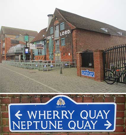
We couldn't find a nameplate at Wherry Lane, but the double
nameplate on the wall of the Salthouse Hotel car park shows the
dividing line between Wherry Quay and Neptune Quay.
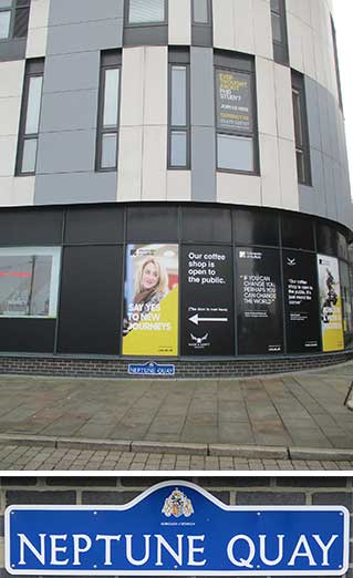
The second Neptune Quay plate is attached to the curving wall of
the University of Suffolk Waterfront Building on the corner of Coprolite Street.
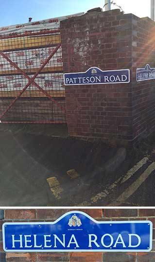
Patteson Road
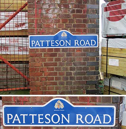
Photographed on one of the fortnightly cargo deliveries by ship
carrying timber to the Anglo-Norden site (hence the blockage shown
above right), the Patteson Road plate is paired with one for Helena
Road – only just visible in the close-up. This is, as far as we know,
the only regular shipped cargo delivery to the Wet Dock in the 21st
century.
Above: both nameplates in one shot, with added sun glare.
Helena Road
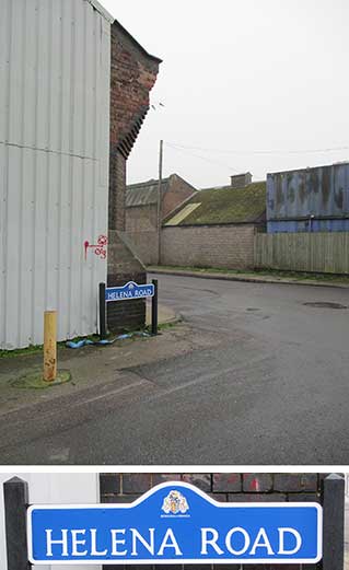
'Helena Road' is a little recognised name for the stretch of the
quay running south from Patteson to Ship Launch Roads. It is shown on
the 1867 map (on our Ransomes site
page) as 'Marine Promenade' – continuing the tree-lined Promenade if
the Island site, connected by the footway over the lock (then
accessible to the public). It is 'Eagle Wharf' on
several Wet Dock maps shown on our Wet Dock
map page. It is 'Helena Road' just
readable on a 1904 map on our Bourne Park
page. A more easily readablemap of the same vintage is
shown on page 8 of the IMT
Occasional Paper No. 1: Quays & wharves of Ipswich.
See our Street name
derivations page for the interesting source of this name.
Ship Launch Road
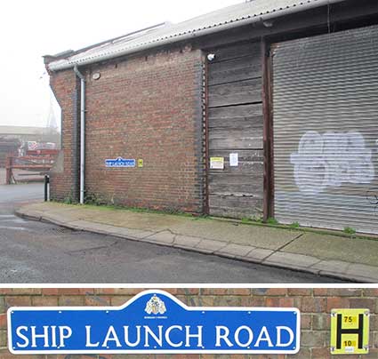
Perhaps surprisingly, little 'ol Ship Launch Road has its own
blue nameplate at this 'very industrial' corner of the Wet Dock.
The name evokes the large number of shipyards which existed at
various times all around the Ipswich docks and beyond. The
traces of a ship launch can be seen nearby – just outside the lock
gates and the yard which built S.B.
Victor in 1895, a barge which has become a talisman of Ipswich
shipping at its berth on Common Quay, in front of the Custom
House.
See also our Street nameplates
page.
Related pages:
The Question Mark
Christie's
warehouse
Bridge
Street
Burton Son & Sanders / Paul's
College Street
Coprolite
Street
Cranfield's
Flour Mill
Custom House
Trinity
House buoy
Edward
Fison Ltd
Ground-level dockside furniture
on: 'The
island', the northern quays
and Ransome's
Orwell Works
Ipswich
Whaling Station?
Isaac Lord
Neptune Inn
clock, garden
and interior
Isaac
Lord 2
The Island
John Good and Sons
Merchant
seamen's memorial
The Mill
Nova Scotia
House
New Cut East
R&W Paul malting
company
Ransomes
Steam
Packet Hotel
Stoke
Bridge(s)
Waterfront
Regeneration Scheme
Wolsey's
Gate
A chance to
compare
Wet Dock 1970s with 2004
Wet Dock maps
Davy's
illustration of the laying of the Wet Dock lock foundation stone,
1839
Outside
the Wet Dock
Maritime Ipswich
'82 festival
Home
Please email any comments
and contributions by clicking here.
Search Ipswich
Historic Lettering
©2004
Copyright
throughout the Ipswich
Historic Lettering site: Borin Van Loon
No reproduction of text or images without express written permission